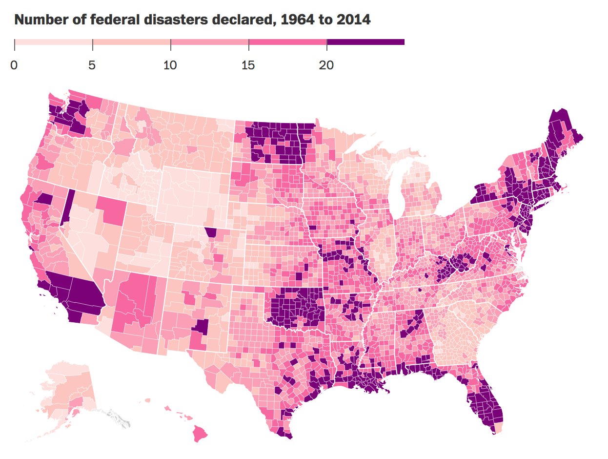
Fires. Floods. Storms. Hurricanes. Volcanoes! The Federal Emergency Management Agency has declared more than 3,000 disasters since 1953, covering the gamut of large-scale calamities ranging from tornadoes to terrorism, and everything in between. Since 1964, they’ve been tracking these disaster declarations at the county level, and Christopher Ingraham has mapped. Click the link below to see more detail.
Earthquakes, floods and volcanoes: The most disaster-prone places in America


